Green Ridge, Blackwater Falls and McGaheysville

We still have beautiful autumn weather and decided to head out again for a short (3 night) camping trip.  We went to Pennsylvania last time and going West toward West Virginia seems natural if a little repetitive.  But there are lots of areas we have not been.

Case in point, we always stayed at Savage River / Big Run but leave Green Ridge by the wayside.  Its a little closer to home and by reputation a lot busier so we avoided it until now.  But hey, lets try it out

Saturday.  Green Ridge State Forest.  First of all, registration for a campsite is a royal pain in the rear.  Some bizarre combination of sign-up sheet with missing pages, unclear instructions, line-ups of campers, odd permits for firewood harvesting (??) and so on.  Basically a total mess.  But we signed up, paid our $10 and went 5 miles of gravel road to the site hoping it would be free and – surprise – it actually was.  We had a lot of daylight left and decided to “claim” the site with a camping chair and some notes before driving 5min toward a popular trailhead.

The trail itself was beautiful, about 4 miles with virtually no elevation change, just a fun walk through the park.  Quite busy though.

We got back to our site and the camping chair we had left to “signal” that we booked it had been stolen.  It was a cheap, sub- $20 chair but its annoying to have stuff stolen but whatever.  We had an amazing camp site with great fire place, no neighbors and great weather.  We chatted until 11:00pm with stars and planets above us – it was really beautiful.

Camp at: 39.704020, -78.483460

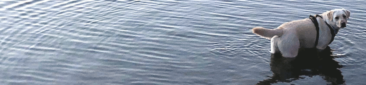
Sunday.  With an early start, we headed out toward the Blackwater Falls State Park in West Virginia.  It had been on our list for a few weeks but it requires online booking and that was never available.  Its a pretty busy area of the State and the weather was gorgeous, we expected it to be very busy.  And in fact the park was packed and so was the campground but only the “hook up” section.  We hiked the park for a few hours but when we had to line up to see the famous falls, decided we should take a break, walk through the grounds a little and take it easy.  The foliage was gorgeous and we had an amazing 4 mile or so stroll.  The campsite btw, backs into the woods and has a Disc Golf (Frisbee?) course behind it.  I.e. nobody is there and lots of space for the dog to run…

Monday

Alright, weekend is over, the hordes have dwindled and we have the park (nearly) to ourselves.  We pack the van up and just bounce to the other side of the gorge

Great 2.6mile walk in the woods

to scope out the hiking / cross country skiing trails there.  Its very pretty, thick Rhododendron and its quite boggy – this must be mosquito hell during  the  summer.  Now it was gorgeous hiking, only saw one or two people over the entire time.

The area is really designed for cross country skiing and we wondered if they allowed snowshoeing / hiking there as well, can’t really take the dog skiing.
Great lunch at the Resort (all outside, COVID-19 etc etc) and then straight shot back toward Seneca Rocks.  We had been there before and really didn’t want to hike it again but the picnic area with the adjacent creek / river made a very natural stop.  Chance to break out the drone again for some water shots.

The quality of this clip is terrible, turns out the SD card died and all I had was the stream off the phone.  Real bummer, there were tons of nice scenes there.

Then onwards to the camp (via Harvest Host) for the night, this time a Vineyard / Winery (Brix & Columns) in Virginia.  The hosts were incredibly supportive and had a friendly Great Dane puppy running among their guests which spooked our dog.  As usual, the wine is a matter of taste but the view was unbelievable.

Camp.  38.36915, -78.69737

Tuesday

Back North and into the Shenandoah.  Not sure if we are jaded but the whole “Shenandoah” experience is wearing off.  Winding roads are not the problem but we didn’t have the urge to stop at every single look out to take a photo of the foliage.  Pre-lunch, traffic was alright and we checked in with the rangers for a single short (but very steep) hike with an incredible view (lower hawksbill trail up to . Turns out, this is actually the highest point in the Shenandoah Park and it was truly spectacular.

 And that was that, we aimed North and headed home, with one slight change, we took Whites Ferry instead of taking the obvious route via I66/I495.  Not sure if that was faster but it definitely was prettier.

Apalachia September 2020

Technical issues with the front control board (“eyebrow”) of our campervan “Serenity” had prevented us going on a July / August trip and while we were pretty annoyed with that, in hindsight it was the right choice. We had a 3 month heatwave with temperatures 28-30C every day, mosquitoes the size of small cats and just brutal humidity.  We could have gone West to – say – Idaho but neither of us really had the motivation to spend days and days in the van just to “get there”.  So, we staid home until the weather cooled a little, labor day arrived and forced children and parents back into their suburbs.

So, we planned a short 4-night trip to West Virginia and Virginia, in part following routes that we had previously scouted. The idea was to explore left and right on the way, keep the miles low and allow for sidetrips and stops to check out interesting things.  We checked out the camping spots online but did not really research hikes and attractions. We sort of thought we could do this on the road – that was a mistake as there was hardly any internet or cell phone connectivity.

Wednesday 09/10/2020.  Left the house at ~ 11:00 and heading (via McDonalds!) to Savage River State Park in Maryland. We had been there twice already and its a great space to camp, by a decent-size creek with lots of firewood nearby.  We have rarely seen anyone there, its a $10 fee and basically its about as isolated in a fairly steep valley as it gets.  We scoped around and instead of camping in the “Big Run” valley, we headed out to the Elk Lick run – for no good reason other than that we had not been there before.  It turned out to be just the same, maybe a little more traffic on the road (the road leads directly into New Germany State Park).  The camp was nice, the dog could run free and explore a little but being in the steep valley means that the sun drops quickly and rises late, i.e. its dark.  Really dark. There also isn’t a real hiking trail anywhere. I think the entire park is designed as a convenient camp site for fishermen using the adjacent Savage River Reservoir – which really looks amazing. We should bring a canoe next time and explore that a little.

Camp at 39.60424, -79.09118

Thursday 9/11/2020

Pretty dark morning but good weather, headed out without starting another fire.   Checked out a few more possible campsites on Savage River Road between Elk Lick and Big Run.  More overflow but they should work.  Headed generally south, passed Dolly Sods and headed to Seneca Rocks.  A really nice picnic site right by the trailhead, parked Serenity and headed up the obvious trail.  The trail has some ascent but rewarded with an awesome view from the lookout.  The trail seemed to continue but tons of signs warn against it and especially with dog / leash, we didn’t feel like exploring beyond the marked trail.

Headed back, dropped the dog into the creek to cool down and got back into the van.  Quick stop for ice cream at the local tourist trap where the most displayed items were confederate flags carefully venerated by sneezing women who proclaim that Corona Virus is an invention from “The Libs”.  I am sure they sell white robes and hemp ropes as well but we didn’t stick around too long.

Btw, these mountain routes take their toll on our already pathetic gas mileage.  We were filling up every time we hit 3/4 tank, Serenity makes about 12miles/gallon out there which is still slightly less than a battle tank but please don’t anyone tell Greta Thunberg.  Headed out toward the campsite Island Camp Ground with some navigation challenges.  Basically, there is no cell phone or data connectivity anywhere and navigation is entirely by map – we use Gaia which works reasonably well but it is a transition from following  a prepared route to navigating 1980’s style.

Island Campground was my favorite campsite of the trip – despite being neither spectacular nor having real hikes nearby.  Its a small place, clearly designed for hunters to just camp out for the night but nobody was there when we set up at the farthest spot.  It has a solid creek (“East Fork Greenbrier River”) right behind it with tons of opportunity for the dog to fish for gnats and me to collect firewood. The road is quite close but there was little traffic at night.   Great place.

Camp at 38.57842, -79.70436

Friday 9/12/2020

Headed out toward the next place with few ideas where to hike and what to do.  Found a friendly USFS guy at a “closed” office in Marliton who recommended the “High Rocks Trail”, a short (3 miles) in/out relatively flat hike along the “Highland Scenic Hwy”.  Really nice place, great for lunch breaks and amazing views.

Yeah, that trail was really nice.

From there headed back out on 39 toward the next campsite – Blowing Springs Campground in Washington & Jefferson Forest.  The campground has 2 “tiers” with the lower one having far bigger spaces but is overgrown with grass and has tons of bugs.  The upper tier has fairly small pads but there was only one other group and we squeezed the van into a flat area and took off for a hike along the local river.  The trail is flat, basically a road and the scenery was more like Colorado than Virginia.  It was absolutely gorgeous.  We took a swim in the creek with the dog, paddled along a wee waterfall for some time and basically enjoyed being in the water. It was awesome.  I wish I had a working drone, that was the perfect place for some areal shots.

Camp: 38.069263, -79.883455

Saturday 9/13/2020

Headed out relatively late, dog and I explored the campsite for a while, went back to the creek and tried to find the “Blowing Springs”.  Gaia suggests its at the entrance of the park on the other side of 39 and yes, there are springs coming out of an old concrete wall with some cemented pipes that could indeed blow air – didn’t really see anything though.

Left toward the Shenandoah ridge again with rain coming down for the first time this trip. Quite a bit of rain, actually.  We headed into the park itself and had a long lunch break to see if the rain would clear but when it didn’t, dog and I took a quick local walk, Dear Den peak or something.  Drenched and miserable, quite a steep climb, the dog hated it and definitely thought there were bears, barking, neck hair raised, all of that. Interestingly, the local ham radio club had set up a repeater up there with a water station.  When we came e back down, fired up the HT and chatted with the guy who actually manages that repeater.  Great guy.

Headed to the last campsite of the trip, a local winery in Virginia called Five Oaks Vineyard.  Small operation but they allow camping there via the Harvest Host membership.  We parked the van at an absolutely stunning position overlooking the entire valley and up into the Blue Ridge Mountains. Amazing location – loved it.  Slept with the back of the van open, no bugs, weird owls but otherwise quiet and just perfect last night.

Camp : 38.139308, -78.319041

Sunday 9/14/2020

Alright, lets go home!  Took of relatively early since the weather was gorgeous and we (ok: me) wanted to get a nice hike in before we get on the highway.  We decided to drive back into the Shenandoah Natl.Park – by now we can gauge how long it will take us to get home which makes planning much easier.

The weather was awesome, could not have been better. Some eerie fog blew off with the sun and then all that was left was a perfect walking day.  We had lots of recommendations but chose a circular hike starting at “Fisher’s Gap Overlook”, 4 1/2 miles of pretty steep up/down.   Quite a busy hike – I mean its Sunday, gorgeous weather and we are in a National Park and the dog really resented to be on-leash all the time and was completely wiped out by the end.


And that was it, heading back home via known routes.  Lots and lots of traffic as usual, maybe coming back on Sunday isn’t such a great idea.  But it was a great trip.

Rocky Gap and Antietam

Our first shake-out trip with “Serenity” went to Rocky Gap State Park in Maryland, a couple of hours drive. The idea was to use whatever season we had left to test the van, equipment and attitude before we mothball her for the winter. Rocky Gap is close, easy to get to and quite nice, it has a large lake with limited hiking but overall is pleasant for a quick outing. We squeezed Serenity between other vans, trailers and tents and with early dusk, didn’t have much time to explore before starting the fire and shutting down for the evening.

There is a weird atmosphere in these shared camp grounds, neighbors on all sides and even though everyone is considerate, the background noise of “camping” is always there. People walk with bouncing headlights to and from the washrooms keeping the dog on alert. Having the dog on-leash (a long one) kind of works but it would be great to have her free to roam the site and explore.

Overall, the camp-site and park are nice site but there isn’t much to do – other than the lake itself, the trails are not very inspiring and the entire park is boxed in by roads and agricultural land. Its alright for a night out but I would not want to spend more time there

The dog wakes up ~ 6am no matter what which means that we are going for a walk. Its dark in October and the landscape is not super exciting. Overcast as well, so no real good photo opportunities during sunrise but we put in a 2h walk along the lake shore to spend the time. When we come back, quick breakfast and departure, heading roughly back.

On the way back, we stopped over at Antietam and drove / walked the various locations. Its close but I had never been there and like all battlefields, the idyllic, pastoral settings creates a very disconcerting contrast with the description of the slaughter that happened here. Unlike Gettysburg, Antietam appears very small in size. The sheer number of soldiers and artillery that squeezed into this tiny area must have been staggering. It probably contributed to the death count simply because in close quarters communication failed with smoke obscuring the field and lines never clean. Constant skirmishes and outright barrages without the ability to retreat, reform and resupply must have made for a horrifying experience for everyone who lived through it. In the end, there are no winners, just losers.

It didn’t help that it started raining hard and neither of us was really in the mood for more hiking, soaked, cold and with home so close by, we heading back.

Overall, Rocky Gap can easily be missed but Antietam is worth a visit – maybe take a guided tour next or read up beforehand.